Mount Hood Auto Stages: From Rugged Roads to Modern Highways

Mount Hood Auto Stages: From Rugged Roads to Modern Highways

The Rise and Fall of Primitive Travel on the Old Barlow Road

The Early Days of the Mount Hood Auto Stages

In the early 20th century, long before travelers zipped up Highway 26 to the ski lifts and resorts of Mount Hood, the trip to the mountain was rugged and uncertain. The road, built on the bones of the old Barlow Trail, was steep, narrow, and either muddy or dusty depending on the season. For those without their own means of transportation—and even for those who did—reliable travel meant trusting the early Mount Hood auto stages and their legendary drivers who knew every twist, rut, and washout of the mountain road.

Olinger Stages to Mount Hood.
Olinger Stages to Mount Hood

The Route to the Mountain

Before the 1880s, travelers followed the original Barlow Trail, carved out by immigrant wagon trains in the 1840s to the 1860’s. This immigrant trail came from Central Oregon and passed over Mount Hood’s southern shoulder. The route took travelers through the area that we know today on the south side of Mount Hood. Coming down from the mountain the route followed the north side of the Zigzag River and then crossed the Sandy River to the north side and through what we now know as Marmot. This remained the primary route until settlement increased east of Sandy.

In the 1880s, a new south side road connected Sandy to Government Camp by following the south bank of the Sandy River. This alternative offered gentler grades, primitive but useful bridges creating more reliable access. Consequently, it soon became the main road to and from the mountain. Meanwhile, the Marmot Road continued as a scenic alternate, especially for travelers heading to Aschoff’s Mountain Home.

The primary route—used by both stagecoaches and auto stages—passed through Sandy, Cherryville, Brightwood, Welches, Zigzag, Rhododendron, and Government Camp. Notable stops included the Cherryville Hotel, Welch’s Hotel, Tawney’s and the Rhododendron Inn, and others.

Mount Hood Auto Stages - Rhododendron Inn
The Rhododendron Inn

The Stage Lines and Their Drivers

Initially, travelers relied on horse-drawn stages operated by local residents. Joe Meinig and Walter Ziegler were among the best-known drivers in those early days. However, as the road improved and mountain tourism grew, motorized stages entered the picture.

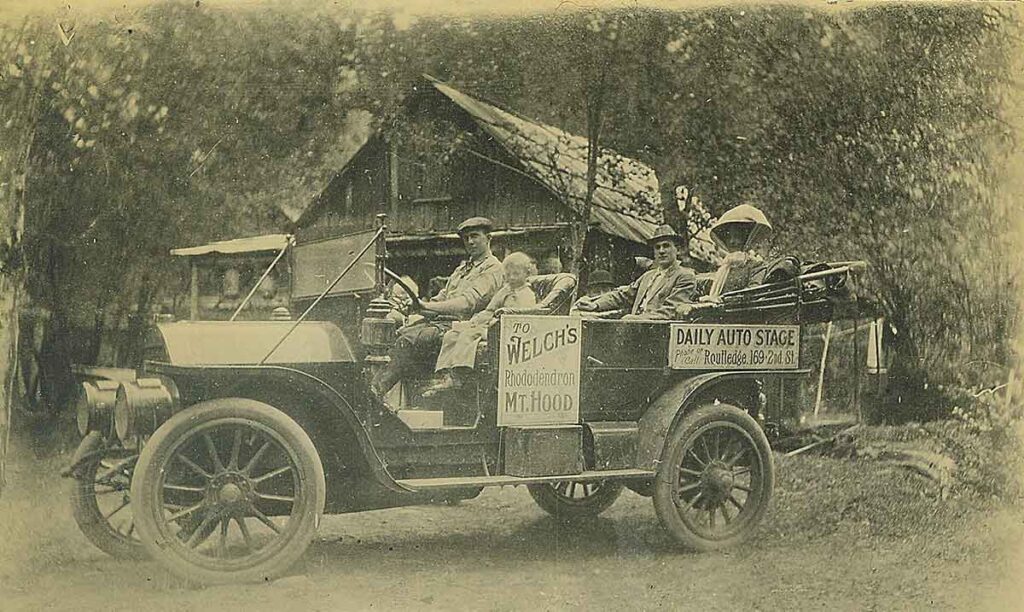
By the 1910s, auto stages had largely replaced horse-drawn wagons. Bob Elliott, a Sandy garage owner, led the way with one of the first regular lines to Government Camp. His rugged fleet of Pierce-Arrows, Cadillacs, and White touring cars came equipped with chains, spare tires, and tools for inevitable roadside repairs.

One of the most prominent operations was Reliance Mount Hood Stages. They offered daily trips from Portland’s eastside waterfront and coordinated with nearly every lodging stop along the route. Their Touring Cars became a familiar sight climbing the dusty grades to Rhododendron and beyond.

Among the legendary drivers was Dr. Ivan M. Wooley. His memoir, Off to Mt. Hood – An Auto Biography Of The Old Road, preserves vivid recollections of the people, places, and perils of early auto stage travel. His storytelling has given us one of the richest surviving records of this vanished era.

Ivan Woolley Stuck on the Road to Mount Hood

Hard Roads and Gritty Travel

Despite the switch from horses to horsepower, travel remained difficult. The roads were merely widened wagon paths. On steep hills like Laurel Hill and McIntyre Hill, passengers often had to walk. The latter, near Brightwood, posed such a challenge that hotelier John McIntyre charged motorists a fee to haul their cars up the grade with his horses. Eventually, widening the road, regrading the hills and decreasing the grades helped. Still, early autos struggled.

Drivers had to wear many hats: mechanic, navigator, and even peacemaker. They fixed broken axles, crossed flooded creeks, and comforted uneasy passengers. Some vehicles towed freight. Others had canvas tops for sun and rain. The trip could last all day, but for many, that was part of the fun.

Mount Hood Auto Stages
Broke down in Government Camp

Mountain Tourism and the Resorts That Made It Possible

The auto stages helped turn Mount Hood into a major Oregon destination. Easier access drew tourists eager to escape city heat or enjoy snowy slopes. Resorts like Welch’s Ranch, Arrah Wanna Lodge, Tawney’s Mountain Home, and the Rhododendron Inn thrived. They offered lodging, camping, hearty meals, hunting, fishing, hiking, dances and community bonfires. Most worked directly with stage lines, ensuring guests could be dropped off at their doorsteps. Back then, the journey, the lodging, and the scenery created a complete experience.

Reliance Auto Stages at Welches

The Automobile Takes Over

By the mid-1920s, personal automobiles had changed everything. Tourists no longer needed to reserve stage seats. They could drive, stop where they pleased, and enjoy more freedom. Ironically, the new Mount Hood Loop Highway—built to improve access—also ended the era of the auto stage. Independence had arrived.

Mount Hood Auto Stages
The Mount Hood Loop Highway at Alder Creek on The Road to Mount Hood

The End of the Line for The Mount Hood Auto Stages

In 1923, the Mount Hood Loop Highway was completed, dramatically altering travel to the mountain. With the addition of a road to Hood River on the east side, the full loop was in place.

As roads improved and cars became more dependable, scheduled auto stages became obsolete. Tourists drove themselves, and although the mountain resorts endured, the days of colorful drivers and mechanical struggles quietly faded away.

Reliance Auto Stages Advertisement

Love Mount Hood History?

Discover more local stories, rare photos, and forgotten places:

Follow the trails. Meet the people. Uncover the past.

Burnt Lake Fire 1904: How the Lake Got Its Name

Burnt Lake Fire 1904: How the Lake Got Its Name

The Burnt Lake Fire of 1904 Still Leaves a Mark

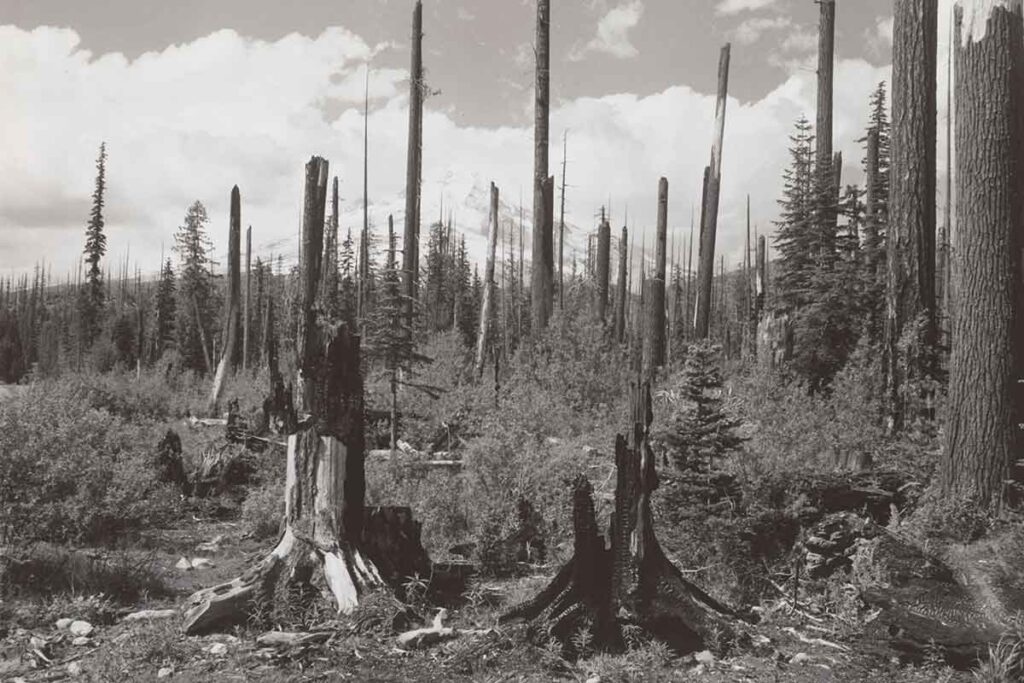
If you’ve ever taken the trail up to Burnt Lake on the west side of Mount Hood, you’ve probably noticed the open ridges and the snags along the way—scarred trees that stand like ghosts among the newer growth. The Burnt Lake Fire of 1904 swept through this area, leaving damage so severe that the lake was named for it. Though the forest has mostly grown back, signs of that fire still linger, more than 120 years later.

Where Is Burnt Lake?

Burnt Lake sits in the Mount Hood National Forest, just east of Rhododendron. The trail climbs through a mix of Douglas fir, hemlock, and alder before reaching a quiet alpine basin with a view of Mount Hood reflected in the water. It’s a peaceful place now. However, in 1904, fire transformed the scene in a matter of days.

Burnt Lake Fire 1904
Burnt Lake Fire 1904 – Photo Cheryl Hill – www.cherylhill.net

How the Burnt Lake Fire of 1904 Started

On August 25, 1904, according to newspaper accounts, a man named Henry Harmand was burning brush near the Zigzag River. The fire quickly spread beyond his control. Based on land records and name variations common at the time, it’s likely that Henry Harmand was actually Heinrich “Henry” Haman, a homesteader who had settled in the area that would later become the townsite of Rhododendron.

That summer brought hot, dry conditions, and strong east winds fanned the flames. Once the fire reached thick timber, it moved fast. It tore across the slopes above Rhododendron, swept through the Burnt Lake Basin, and pushed toward Mount Hood and the trails to Lost Lake and Bull Run, Lolo Pass today.

Smoke and Flame Across Mount Hood’s West Side

Eyewitnesses saw a “wall of flame” rising up the ridges. Meanwhile, thick smoke drifted down into Government Camp and Sandy, where locals said they could hardly see. There were no fire crews in those days—only settlers, a few hikers, and travelers on horseback. Because of this, there was no way to stop it. The fire burned for days.

By August 28, 1904, the Oregon Daily Journal and Sunday Oregonian reported that the blaze still raged across the western slope of Mount Hood. The fire had destroyed stands of old-growth forest. Trails vanished under ash and smoke. Charred trees marked the fire’s path from Zigzag Creek to Zigzag Ridge and then toward Burnt Lake.

How Burnt Lake Got Its Name

After the fire, people began referring to the lake as Burnt Lake, a name that stuck. The name became part of local memory—and part of the map. Even today, hikers still pass the reminders. Dead snags are still found along the trail. The ridgeline above the lake opens to the sky where the canopy hasn’t fully returned. If you pay attention, you can still see the shape of the fire in the land. The Burnt Lake Fire of 1904 changed more than the trees—it gave a name to the place itself.

The Legacy of the Burnt Lake Fire 1904

The Burnt Lake Fire of 1904 was one of the first major wildfires recorded on Mount Hood’s west side. It reshaped the forest, scarred the ridges, and gave a name to one of the area’s most scenic lakes. Today, Burnt Lake still reflects Mount Hood—but also a story that burned its way into the history of this mountain.


Related Reading

Howard’s Hotel at Sharon Springs – A forgotten hotel from the same era, in Zigzag.
https://mounthoodhistory.com/zigzag/howards-hotel-sharon-springs/

The 1910 Mount Hood Fire – A massive blaze that followed just six years later.
https://mounthoodhistory.com/mount-hood/the-1910-mount-hood-fire/

History of Rhododendron, Oregon – The nearby town impacted by smoke and fire.
https://mounthoodhistory.com/mount-hood/rhododendron-oregon-history/

Billy Welch Welches Oregon

Billy Welch Welches Oregon

Billy Welch: The Heart and Soul of Welches, Oregon

A Young Pioneer – Billy Welch Welches Oregon

Billy Welch Welches Oregon – In the shadow of Mount Hood, where the Salmon River winds through a valley rich in history, the legacy of William “Billy” Welch remains deeply embedded in the land he called home. Billy Welch was more than just a homesteader — he was a community builder, a businessman, and a generous soul whose efforts helped shape the town that bears his family name.

Billy Welch was born on December 24, 1866. At the age of 16, he moved with his father, Samuel “Uncle Sam” Welch, to the Salmon River Valley. In 1882, they each claimed 160 acres of land and built a homestead. Over time, their property expanded to 1,000 acres.

Billy Welch Welches Oregon
Billy and Sam Welch with Neighbors

Life on the Welch Ranch

The Welch ranch was a self-sufficient farm with pastures, barns, livestock, orchards, and a vegetable garden. Moreover, the nearby hills provided ample game. In addition, the Salmon River, which runs through the land, was teeming with fish. Billy continued to run the property as a ranch. Billy married Mamie Kopper in 1902 but Mamie died in 1903. Their daughter Lutie “Welch” Bailey was a resident of the area until her death.

Billy Welch Welches Oregon
Billy Welch having fun with friends

Building a Community

Billy cared deeply about the growing settlement. In 1886, with neighbor Firmer Walkley, he claimed a one-acre plot at the junction of the Barlow Road and the road to Welches. They used this land to build the first Welches School. As a result, this early investment in education showed Billy’s dedication to the families establishing roots in the valley.

After Samuel’s death in 1889, Billy inherited the land and continued to develop the property. Not long after, tourists seeking respite from the city began arriving. Therefore, Billy responded by adapting the ranch to welcome them.

Welches Becomes a Destination

By 1905, the property was leased to Clinton “Linny” Kern and a Mr. Wrenn as a hotel resort. To keep up with demand of the tourists that were coming, Billy expanded the facilities. He added a dining hall, a dance hall, a store and a post office near the Welches Hotel. As demand increased, he also added tent cabins throughout the area. Billy took the hotel and property back from Kern and Wrenn in 1909.

In addition to running the resort, Billy remained focused on the growing community. In fact, he often supported neighbors and welcomed guests, making the Welch homestead a hub of local life. Furthermore, his hospitality created lasting memories for the many visitors who lived there or those who passed through.

Camper as Welches Oregon

A Life Full of Laughter and Music

People remember Billy as a jolly soul — good-natured, generous, and full of humor. He played the fiddle and hosted Saturday night dances that would sometimes last through the night, which were popular with both locals and visitors. These lively events took place in the dance hall above his store. There are stories told how the whole building seemed to rock while everyone danced to Billy and his fiddle and the occasional volunteer on the piano. The hall had an east-facing balcony. From there, guests cooled off and enjoyed moonlit views of Hunchback Mountain.

Billy also loved the outdoors. He was an avid hunter who relied on his hounds to flush out deer. Notably, his favorite dog, Leader, was a loyal companion on many trips. It’s common to see his dog next to him in photos. Whether he was playing music, greeting visitors, or roaming the forest with his dogs, Billy lived life with energy and joy.

Billy Welch Welches Oregon
Billy Welch

A Strong Partnership

In April 1911, Billy married Jennie Faubion. She was the daughter of local homesteaders William and Anna Faubion. Together, Billy and Jennie managed the resort, store, post office, and dance hall. Jennie played a vital role in the operation and success of their ventures.

As Welches attracted more visitors, Billy began selling small plots of land to regular campers. Consequently, these families built summer cabins and returned year after year. This trend marked the beginning of Welches as a seasonal destination for recreation and relaxation that still exists today.

Over time, the town grew. Thanks to the couple’s efforts, Welches developed a strong reputation as a friendly, welcoming place. It became a destination loved by visitors and settlers alike. In many ways, their teamwork laid the foundation for the community spirit that still exists today.

Miss Jennie Faubion before she married Billy

Leaving a Legacy

In 1928, Billy leased part of his land to Ralph Waale, who constructed a nine-hole golf course and operated it until 1939. Eventually, after Waale stepped away, Billy and Jennie resumed control and managed the golf course until 1942.

Billy also served as the first postmaster of Welches, from 1905 until 1940. Through his service, he helped the growing community stay connected with the wider world. His work laid the foundation for the town’s lasting success. Additionally, after Billy passed, Jennie continued in this role until 1960. Her contributions further strengthened the continuity and spirit of the town.

Lutie Welch Baily, Billy Welch and Jennie Welch

A Lasting Memory

Billy Welch passed away on October 30, 1942. The land he helped develop eventually became a resort featuring a world-class golf course with sweeping views in all directions. Today, it remains a popular destination that continues to welcome visitors. Now known as The Mt. Hood Resort, it still sits in the same scenic valley that Billy and his father once called home.

Even though the cedar shake cabins and dance halls have almost faded, Billy’s name and spirit live on in Welches. He was more than a pioneer — he was the heart and soul of a community that still thrives in the shadow of Mount Hood.

Ultimately, Billy Welch’s legacy is one of vision, opportunity, connection, and joy. It serves as a reminder that one person’s dedication can shape an entire region for generations to come.

The Welches Hotel

Mount Hood Forest Fires of 1910

Mount Hood Forest Fires of 1910

Eyewitness Report from The 1910 Oregon Daily Journal

1910 was a tragic year for forest fires

Mt Hood Forest Fires of 1910 – The summer of 1910 brought devastating forest fires to the Mount Hood area, with flames sweeping across Zigzag Mountain, Huckleberry Mountain, Wildcat Mountain, and the surrounding ridges. This firsthand account from the Portland Oregon Daily Journal, published on August 28, 1910, gives us a rare look into the chaos and hardship faced by locals, vacationers, and especially the Indigenous berry pickers during that tragic event.

“The Indians and berry pickers suffered terribly. Hundreds of Indians who were camping and picking berries in the woods were robbed of their all by the fire, their blankets burned, their stock killed and their tents and camp equipment destroyed. So it was with many white campers. No one will ever know just how many burned to death, for there may have been hundreds of berry pickers in the dense woods through which the fire ate.

As someone who has explored and photographed this very landscape, it’s sobering to read how much of a conflagration this fire was and how many people lost their lives. While some of the places mentioned — like the Maulding Hotel and Rhododendron Inn — are now long gone or forgotten, this report captures a moment in time when fire was an ever-present threat in the Oregon woods. A fact that we, in this modern time, seem to ignore until it’s an immediate threat to us.

Read the following about the tragic Mt Hood Forest Fires of 1910

Original Article: The Portland Oregon Daily Journal, August 28, 1910

LOCAL PARTY NEAR MOUNT HOOD NOT MENACED BY FIRE

Members Returning From the Maulding Hotel Say Flames Along Mountain Road Under Control; 4 Houses Burned

Thomas McCusker and his son-in-law, E.M. Fauch, who returned yesterday by auto from the Maulding hotel, near Welch’s camp, on the Mount Hood road, with Mrs. Custer, Miss Helen McCusker and Mrs. E.F. Cannon, reported the forest fires that raged along the highway last week, greatly abated. They arrived in Portland about 3 o’clock yesterday afternoon.

“The fire started,” said Mr. McCusker, on Zig-zag mountain, according to reports and is supposed to have been caused by the carelessness of forest rangers. It swept down the Sandy road and river to what is now known as the McIntyre place. So far as I was able to learn only four houses were burned. On Wildcat mountain a squaw and pappoose were burned to death, according to the reports made by hundreds of Indians who were driven out of the brush.

“Mr. Fouch and I went to the Maulding hotel Friday to get my wife and daughter and Mrs. Cannon. We found that the hotel was in no danger, but that every precaution had been taken. Maulding’s place is about three miles south of Rhododendron inn around which the fire swept.

Mountains Swept Clean

“When we left the Mount Hood district the fires were still burning, but were under control. It was feared they were beating back into the mountains. The wind storm that rose up Tuesday about midnight and gave impetus to the flames, has subsided and unless the wind, which was light and blowing to the northeast, changes, I believe the fires will be extinguished without trouble.

“The west side of Huckleberry mountain has been swept clean of all growth, and Zig-zag and Wildcat mountains have been denuded. Fences were burned out all along the road and hay and other crops gone. On the ground over which the fire swept there is no vegetable life left, but in many places smothered by flames, the standing timber is not so badly hurt as supposed. In many cases the fire was swept through so swiftly by the strong wind, that it burned only the underbrush and did not really damage the larger trees.

“Bull Run is in no danger and from what I learned has not been endangered at any time. Of course, if the wind changes suddenly and freshens up considerably, the flames may be carried into the reserve, but such is not likely.

Settlers Leave in Hurry

“Everywhere we saw evidence of the haste in which people left the burned region. Along the sides of the roads we saw camps, deserted days ago, with the dishes still on tables, and clothing hanging on the lines. We met one camper yesterday hauling a half of a dining room table. He told us that the other half had burned.

“The Indians and berry pickers suffered terribly. Hundreds of Indians who were camping and picking berries in the woods were robbed of their all by the fire, their blankets burned, their stock killed and their tents and camp equipment destroyed. So it was with many white campers. No one will ever know just how many burned to death, for there may have been hundreds of berry pickers in the dense woods through which the fire ate.

“People who are still at Maulding’s place, Welch’s and at Rhododendron asked me to let the newspapers know that the danger was past, so that their friends and relatives may know they are safe. The stages are having trouble getting in and out and it will be several days before all those who desire to leave can get out.

“At Maulding’s hotel there are a Mr. McKnight of Portland, and his three sisters; Mrs. Rasmussen and two daughters; T.G. Green, and two children, Dr. Stolte’s wife and son of Douglas Taylor, formerly city engineer of Portland, are at the hotel. Mr. Taylor is out in the woods on a surveying trip. He did not encounter the flames.”

Reflections on the Mt Hood Forest Fires of 1910

This is one of the most detailed accounts I’ve found about the 1910 fires near our local communities from Brightwood to Rhododendron. It touches on places I know well and brings to life a time when fire danger meant loading what you could into a wagon and hoping the wind shifted.

Today we think of wildfire as a modern problem, but this reminds us it’s been with us a long time. I’ll continue sharing these kinds of historical pieces here as I dig deeper into the story of Mount Hood’s past — and if you’ve got local stories or family history connected to this era, I’d love to hear them.

Read here for another close call with a Mt Hood Forest Fire in 1952

Mt Hood Forest Fires of 1910 - The Portland Oregon Daily Journal, August 28, 1910

Howard’s Hotel at Sharon Springs

Howard’s Hotel at Sharon Springs

A Lost Piece of Zigzag’s Oregon’s History

A Mysterious Rock Wall and a Forgotten Hotel

Howard’s Hotel at Sharon Springs – As you drive along the east end of Barlow Trail Road near the confluence of the Sandy and Zigzag Rivers, you may notice an old moss-covered rock wall. Weathered by time and nature, this beautifully crafted basalt and stone wall stands as a silent sentinel to the past. Yet, few—if any—know its origins. A 1920 map already labeled it as an “old rock wall.” Historical accounts mention it as a marker near old bridge brow logs from an original Barlow Trail crossing. But why was it built? What once stood behind those stones?

Piecing together historical maps, newspaper articles, and land records points to one answer: Howard’s Hotel at Sharon Springs. Built in the early 1910s, this long-forgotten inn lasted only a few years before fire destroyed it. Unlike the well-remembered Welch’s Hotel in Welches, McIntyre’s early hotel, or the Rhododendron Inn, Howard’s Hotel vanished from collective memory. Yet, its story is worth rediscovering.

The Mount Hood Road and the Growth of Tourism

The land where Howard’s Hotel stood was known as Sharon Springs, named after a small, year-round spring that still flows into Clear Creek near the Sandy and Zigzag Rivers. W.R. McGarry originally owned the land and subdivided it in the early 1900s as tourism in the Mount Hood region grew.

This growth followed the expansion of the Barlow Road, a pioneer-era route that later became a toll road. By the early 1900s, it transitioned into an automobile road, drawing more visitors. Travelers sought lodging along the way to Government Camp and Mount Hood’s higher elevations. Hotels and lodges sprang up to serve them.

Seeing an opportunity, Mr. and Mrs. Archibald Howard built a hotel at Sharon Springs, close to the Barlow Road and Mount Hood’s foothills.

Howard's Hotel at Sharon Springs

Howard’s Hotel at Sharon Springs: Built for the Boom

Constructed in 1910, Howard’s Hotel was a three-story, 14-room cedar structure. It stood on the north side of the Sandy River along the old north bank road.

From the start, challenges arose. In 1911, a freshet washed away a crucial bridge over the Sandy River near the hotel and damaged two others, the Zigzag River and Bear Creek bridges. Access became difficult, forcing visitors to detour through Brightwood, where J.T. McIntyre had built a bridge.

Plans to rebuild the bridges were made, but the setback likely hurt the hotel’s early success. Meanwhile, competitors like Welch’s Hotel and the Rhododendron Inn thrived with easier access.

Howard's Hotel at Sharon Springs

The Fire That Erased Howard’s Hotel

On a September night in 1912, disaster struck.

A report in The Oregonian (September 14, 1912) stated:

“The home of Mr. and Mrs. S. Howard, near the junction of Sandy and Zigzag River, in the Mount Hood district, known as the Howard Hotel, was destroyed by fire a few nights ago, and Mrs. Howard, who was alone at the time, barely escaped with her life. Fire started in the lower story from sparks from the fireplace after Mrs. Howard had retired for the night in an upper room.”

Mrs. Howard woke to flames blocking the stairs. Forced to escape through a side window, she fled in her night robe.

The hotel burned completely, with nothing saved. The financial loss ranged from $3,500 to $4,000. With no efforts to rebuild, Howard’s Hotel disappeared from both the landscape and local memory.

Why Has Howard’s Hotel Been Forgotten?

Unlike Welch’s Hotel, the Rhododendron Inn, or McIntyre’s Hotel, Howard’s Hotel lasted barely two years. No surviving photographs or major advertisements recorded its existence. Without a rebuilt structure or continued operation, history left it behind.

Nearby hotels thrived because they became part of a lasting tourism infrastructure. Welch’s Hotel evolved into the town of Welches. Rhododendron and Government Camp grew into permanent tourism hubs. But Howard’s Hotel faded, leaving only the rock wall as a possible clue to its past.

A Call for Further Investigation

The rock wall remains the only visible evidence of Howard’s Hotel. Its basalt and stone construction, multiple entryways, and elevated stone columns suggest more than a simple boundary wall.

Could forgotten records, lost photographs, or hidden remnants beneath the forest floor reveal more?

For now, the story of Howard’s Hotel at Sharon Springs remains an intriguing historical mystery—one that deserves to be remembered.

Conclusion: Preserving the Lost History of Howard’s Hotel at Sharon Springs

Howard’s Hotel burned in 1912, but its legacy should not be forgotten. Among the histories of Welches, Brightwood, and Rhododendron, it represents the challenges of early tourism in the Mount Hood wilderness.

Next time you pass through Zigzag, take a moment to consider the rock wall, the spring at Sharon Springs, and the stories hidden beneath the surface.

The past is still there—waiting to be uncovered.

Historic Glass Plate Negatives

Historic Glass Plate Negatives

Ed Robert’s Welches Oregon Photographer

A look back into Welches, Oregon’s past

This is an early view of when Billy Welch’s Ranch was in transition from a camp ground to an era of summer cabins.

This is a 4×6 glass plate negative made by Ed Roberts. The Roberts family were one of the first folks to live in Welches. Ed Roberts was the son of the family who became a photographer and later in life established Roberts Store in Welches. Roberts Store was a favorite spot for locals as well as summer campers and cabin dwellers for many years.

Arrah Wanna Hotel in Wemme Oregon

Arrah Wanna Hotel in Wemme Oregon

A History of Arrah Wanna

The Birth of Arrah Wanna Hotel

Nestled in the picturesque surroundings of the Salmon River in Wemme, Oregon, the Arrah Wanna Lodge began its story in 1909 when George Routledge acquired 160 acres of timberland. At the time, the land sat about a mile from the nearest automobile road, making it an ideal mountain retreat.

That same year, the Mount Hood Hotel Company, led by C. W. Kern, J. R. Routledge, and R. Woods, announced plans to construct a Swiss Chalet-style hotel. Kern had previously operated the Welches Hotel for five years. By 1910, construction had begun on an 80 x 90-foot, two-story building with 40 rooms and wide verandas. The hotel featured rough timber finishes, large stone fireplaces, and running water. The estimated construction cost reached $20,000, and the hotel planned to open for the 1910 season.

Early Years and Challenges

Although the hotel was completed, financial struggles soon arose. Nevertheless, its location and design attracted conventions and gatherings, including a YMCA conference in 1916. Despite these successes, ownership changed in 1918 when J. L. Bowman of the Brownsville Woolen Mill Store in Portland purchased the property. Bowman then leased the hotel to Mr. and Mrs. George L. Spencer, who enhanced its reputation as a high-class resort. They introduced specialty meals, such as chicken dinners and the famous “Spencer Hot Gingerbread.” A giant fir tree near the hotel became a major attraction, measuring 41 feet in circumference and 300 feet tall.

A Tragic Fire and Rebirth

On June 5, 1922, tragedy struck when the Arrah Wanna Hotel burned to the ground. Strong winds fanned the flames, reducing the wooden structure to ruins in just 30 minutes. Fortunately, the surrounding cottages and J. L. Bowman’s summer home survived the disaster.

Determined to rebuild, Bowman oversaw the construction of a new hotel by May 1924. The new lodge featured 17 guest rooms and 10 bungalows. Built primarily of native fir with hard maple floors, the hotel also included modern conveniences. An electric plant at the Salmon River provided power, while hot and cold running water improved guest comfort. Traditional activities such as hiking, trout fishing, and berry picking remained popular. Additionally, a boardwalk along the river and new bungalows enhanced the visitor experience.

Growth and Changing Management

John L. Bowman passed away in July 1928. As the president of the Brownsville Woolen Mills, he had played a significant role in the history of the Arrah Wanna Hotel for a decade.

Throughout the 1920s and 1930s, the Arrah Wanna Hotel underwent various management changes and improvements. Advertisements promoted dining options, including their specialty $1.50 chicken dinners with mashed potatoes and gravy. Entertainment such as music, dancing, and campfire gatherings enriched the guest experience. By 1936, the lodge began serving beer under a new license. Despite these efforts, financial difficulties persisted, leading to periodic closures and the hotel being listed for sale or lease.

Oregon Baptist Church Buys Arrah Wanna

In 1941, the lodge entered a new chapter when a Baptist church group purchased the property for $12,750. Their vision was to create a summer camp, leading to the birth of Camp Arrah Wanna. That summer, the camp hosted its first youth retreat. A five-year improvement plan soon followed, adding a Bible house, tabernacle, dining hall, and swimming pool. Over time, the camp became a cornerstone for religious retreats and youth activities in the area.

Into Modern Times

By 1952, a new swimming pool was constructed, and in 1962, $50,000 was allocated for further improvements. Beginning in 1969, Camp Arrah Wanna became one of the locations hosting Portland Public Schools’ Outdoor School program. During this six-day outdoor experience, sixth-grade students learned about science and nature while immersing themselves in the wilderness.

Today, Camp Arrah Wanna remains under the ownership of the American Baptist Churches of the Central Pacific Coast. It serves as a retreat and recreational facility, also hosting conferences and events for various groups.

Legacy of the Arrah Wanna Hotel

From its early days as a luxurious mountain hotel to its transformation into a church camp and community center, the Arrah Wanna Hotel has played a vital role in Oregon’s history. Its scenic location, engaging activities, and mountain lodge charm continue to captivate visitors. As a beloved landmark in the Mount Hood area, its legacy endures, reflecting the rich heritage of the region.

Zigzag Cabin Owner: A Local Legend

Zigzag Cabin Owner: A Local Legend

Portland’s Buffalo Bill – William DeVeny

An Active Community Participant

In the early 1900s, Portland’s Montavilla neighborhood was home to one of its most fascinating figures: Dr. William DeVeny. Known as the “Buffalo Bill of Portland,” William DeVeny was a community leader, civic advocate, and larger-than-life character. His influence stretched beyond Montavilla and into the Mount Hood region, where he worked to improve access to the wilderness.

DeVeny’s striking appearance—long hair, a thick beard, and signature buckskin attire—earned him his nickname. According to some accounts, Buffalo Bill Cody himself gave him the title. Yet, DeVeny was more than just a local icon—he was a man of action.

A Visionary for Montavilla

DeVeny dedicated himself to improving Montavilla. As secretary of the Montavilla Board of Trade, he led efforts to attract new businesses, including a fruit cannery, chair factory, and broom factory. He also pushed for better schools, clean water, and libraries, believing these essentials would help Montavilla thrive.

One of his most ambitious projects was Montavilla’s annexation to Portland. He argued that annexation would bring stronger infrastructure, including deeper water mains to prevent freezing and increased school funding. Although his campaign initially failed, he continued to fight for it.

In 1907, he ran for city council, hoping to create more change. However, his campaign faced controversy when petition collectors submitted duplicate signatures. Though DeVeny did not commit fraud, officials removed his name from the ballot. This setback ended his political aspirations, but not his commitment to the community.

He saw the need for better roads in the region. To improve access, he led the construction of a road connecting the Mount Hood automobile road to Truman Road on the north side of the Sandy River. The project, called DeVeny Road, required the building of several bridges. This new route made travel easier for settlers, forest rangers, and tourists.

Building Roads to Mount Hood

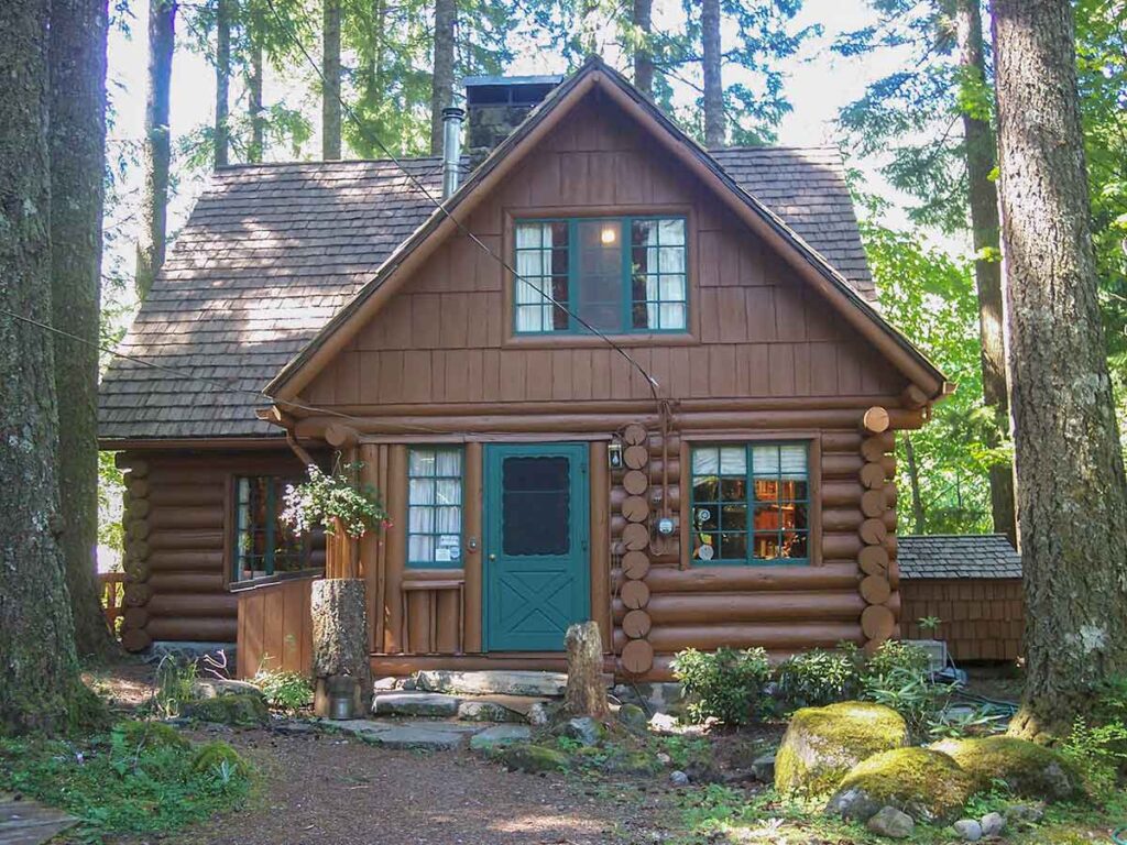
DeVeny’s passion for development extended into the Mount Hood wilderness. He owned a cabin near the mountain, which he called The Scout’s Rest, inspired by Buffalo Bill Cody’s Nebraska ranch.

By 1913, construction was complete. This road became a key link for travelers and helped boost tourism in the Mount Hood region. Eventually, it was renamed Lolo Pass Road, but DeVeny’s work remains a vital part of the area’s history.

A Complex and Evolving Figure

DeVeny’s views changed over time. Once a supporter of military training for boys, he later spoke out against war, particularly as World War I approached. Some believe he changed his stance because his sons became eligible for the draft.

Beyond civic work, DeVeny was a skilled chiropodist (foot doctor) and an accomplished photographer. Alongside his wife, Martha, he operated photography studios before settling in Portland.

He also supported women’s suffrage and equal rights, reflecting a progressive mindset that was ahead of his time.

A Lasting Legacy

Dr. William DeVeny passed away in 1918 at age 65. The Oregonian honored him as a civic leader, community advocate, and friend of famous frontiersmen. His contributions to Montavilla and Mount Hood shaped Oregon’s history in ways still seen today.

Today, hikers in Mount Hood’s forests and residents in Montavilla’s streets walk paths influenced by his work. His life is a powerful reminder of how one determined individual can shape a community’s future.

The Modern Barlow Trail Road

The Modern Barlow Trail Road

The Historic Paths of Barlow Trail Road and Lolo Pass Road

Have you ever driven along Barlow Trail Road or Lolo Pass Road and wondered about their origins? These quiet, winding roads are more than just modern routes—they are living pieces of history.

Long before cars or bicycles rolled over them, these paths were game trails and footpaths used by the region’s first inhabitants. Later, Oregon Trail pioneers relied on them as lifelines to complete their westward journey. Over time, they evolved into crucial connections for local residents and the modern communities we know today.

  and wondered about their origins? These quiet, winding roads are more than just modern routes—they are living pieces of history.

From Wagon Wheels to Hackett Road

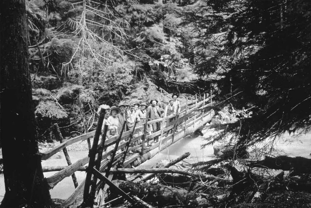
In the mid-1800s, the original Barlow Trail served as a rough but vital route for settlers completing the Oregon Trail. As pioneers descended from Mount Hood, they followed the north side of the Zigzag River until they reached the Sandy River. At the big bend of the Sandy, they crossed over a log bridge built by settlers.

Later, the trail shifted to the south side of the Sandy River, leaving behind remnants of the earlier path. As a result, settlers repurposed parts of the old trail into local roads, including Hackett Road. This road, named after early settlers in the area, still carries their legacy in the name of nearby Hackett Creek.

The McIntyre Bridge: A Critical Connection

By 1910, settlers struggled to access the road on the north side of the Sandy River. Early bridges were unstable and often washed away, making travel difficult. That year, J.T. McIntyre, an early settler in Brightwood, took action. He built a sturdy bridge over the Sandy River, providing reliable access to the road on the north side.

This new bridge transformed travel in the area. Residents could now cross the river safely, and it became a key link for the growing community. Without McIntyre’s efforts, settlers on the north side would have remained isolated from the developing Mount Hood automobile road nearby. Consequently, his work played a crucial role in connecting these remote settlements.

  and wondered about their origins? These quiet, winding roads are more than just modern routes—they are living pieces of history.

The Road to The Truman Farm

Around the same time, Ezra and Eliza Truman homesteaded on the north side of the Sandy River, near Zigzag Ridge. Ezra, a mountain guide and farmer, relied on the newly connected road to reach his homestead. He used it to deliver milk and produce to his neighbors.

Over time, this route became known as Truman Road, named after the family who lived at its farthest end. Even after Ezra’s death in 1917, the road remained essential. It provided access to settler homes, cabins, and lodges, supporting the early tourism industry that grew alongside the increase in automobile travel to Mount Hood. Because of this, the area became a gateway for visitors exploring the region.

  and wondered about their origins? These quiet, winding roads are more than just modern routes—they are living pieces of history.

DeVeny Road: A Valuable Connection

In the early 1900s, Dr. William DeVeny, a Zigzag cabin owner and civic leader from Montavilla (now part of Portland), saw the need for better road access. With support from the Mount Hood Improvement Association and local government funding, he led the construction of DeVeny Road.

The new road linked the Mount Hood automobile road on the south side of the Sandy River to the east end of Truman Road on the north side. By 1913, the project was complete. Bridges were built over Bear Creek, the Zigzag River, and the Sandy River, creating a vital route for settlers, forest rangers, and early visitors to the Mount Hood wilderness. As a result, travel between the two sides of the Sandy River became much easier, further opening the area to development.

  and wondered about their origins? These quiet, winding roads are more than just modern routes—they are living pieces of history.

A Modern Legacy

As time passed, these roads continued to serve local communities while adapting to modern needs. In 1979, the Clackamas County Historical Society honored the pioneers by renaming Truman Road to Barlow Trail Road. This change recognized the historical importance of the original Barlow Trail.

Meanwhile, DeVeny Road became part of Lolo Pass Road, and its original name faded from memory. Yet, the routes themselves remain a testament to those who built them. Although the names have changed, their significance has not been forgotten.

Roads Worth Remembering

Today, whether you’re coming home, heading out, or simply enjoying a scenic drive, you are traveling through history. These roads are more than just asphalt and gravel—they are stories of resilience, determination, and community.

So, next time you find yourself driving down Barlow Trail Road or Lolo Pass Road, take a moment to appreciate the history beneath your wheels. After all, you are following in the footsteps and wagon tracks of those who came before us

  and wondered about their origins? These quiet, winding roads are more than just modern routes—they are living pieces of history.
Mount Hood’s Native Trails

Mount Hood’s Native Trails

A Place of Cultural Significance

It’s not commonly known, but our home on the slopes of Mount Hood is a place of deep cultural importance. For generations, Mount Hood’s Native people traveled here each season, arriving from all directions between spring and autumn to live, hunt, trade, and gather resources.

The place that we call Zigzag today was once a convergence point for three important ancient trails:

  • One trail came from the Columbia River Gorge, following what is now called Lolo Pass.
  • Another came from Central Oregon, crossing the south side of Mount Hood—a path that parts of the Barlow Trail later followed.
  • The third arrived from the west, connecting to the Willamette Valley.

Seasonal Gatherings and Traditions

Although the native people travel and would hunt in this area all year long, each Spring tribes from all around Mount Hood gathered in ancestral camps along the rivers between Government Camp and the town of Sandy, especially at the the confluence of the Sandy and Salmon Rivers. They returned to places that their families had been coming to for centuries.

The purpose of these gatherings was to harvest essential resources and trade with other visiting groups. While the men hunted and fished, the women also fished, harvested food, medicinal roots, and herbs from the area’s plentiful wetlands. They also collected huckleberries on the surrounding hillsides and carefully prepared their bounty for transport back to their winter homes. They would also play games and race horses.

A Tradition That Faded with Time

For thousands of years, these seasonal gatherings remained a vital part of life in this region. However, by the late 19th century, they began to disappear. As disease reduced the Native population and forced relocations to reservations increased, the annual traditions slowly faded.

Samuel and Billy Welch coexisted with the Native people for some time. However, as non-Native settlers arrived to recreate and establish permanent homes, the presence of the original inhabitants diminished.

A Continued Presence in the Region

Even after their seasonal camps had vanished, Native people still traveled along the Barlow Trail from Warm Springs to the Willamette Valley. Many brought herds of horses or sheep to sell. They often stopped overnight in Welches, where Billy Welch provided corrals for their animals.

Honoring the Past

In today’s world, it’s hard to imagine the land we call home as it once was—teeming with life, culture, and tradition for thousands of years. It may seem like distant history, yet in reality, it wasn’t that long ago.

The history of Mount Hood is deeply intertwined with the history of its Native people. Their stories, trails, and traditions are still woven into the landscape, reminding us of those who came before us.

Mount Hood's Native People