Baby Morgan’s Grave: A Tragic Pioneer Story at Summit Meadow

Baby Morgan’s grave – A Lost Child on the Oregon Trail

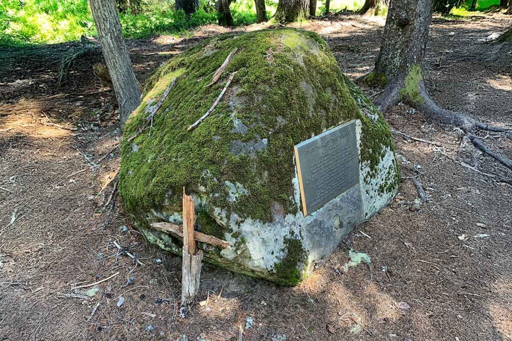
Tucked in the peaceful meadow near Government Camp, Oregon, lies a quiet grave that tells a heartbreaking story. Baby Morgan’s grave is marked by a small bronze plaque mounted on a random boulder named Chimney Rock by immigrants on the Barlow Trail in Summit Meadow. It honors the memory of an infant girl who died during her family’s perilous journey on the Oregon Trail in 1847.

The Morgan Family’s Journey West

Daniel Morgan and Rachel Woodside were among the brave pioneers who crossed the plains in search of a new life in Oregon. Married in 1841 in Cuba, Illinois, the couple traveled west in 1847 with their children: Seth, Thomas, and Anne. They joined what became known as the “Woodsides Train,” a caravan of families heading for the Oregon Territory.

By June, the party reached Independence Rock in Wyoming. There, tragedy struck. Several members fell ill after eating food contaminated by brass cooking vessels. Rachel, just 25 years old and pregnant, died shortly after giving birth to a baby girl.

The Road to Oregon—and More Loss

Relatives stepped in to care for the motherless children, including the newborn. The wagon train pushed on, crossing Idaho and eventually descending into Oregon along the Barlow Trail.

As they neared Mt. Hood in late October, the baby grew weak. According to family history, the infant was injured during a wagon jolt. Jacob Caplinger, a family member, carried her on horseback, hoping to ease her pain. Sadly, she died not long after, on October 24, 1847.

A Burial Beside Chimney Rock

The family buried the baby at Summit Meadow, near a rock described as looking like a “house and chimney.” That landmark later helped descendants locate the gravesite a century later.

In 1957, family members from the Morgan, Caplinger, and Woodside lines placed a plaque on the rock to honor her memory. Since then, they’ve gathered annually at Summit Meadow to remember her and the sacrifices of all Oregon Trail pioneers.

More Stories from Summit Meadow

The Baby Morgan grave isn’t the only historic site at Summit Meadow. The meadow also served as a key rest stop for emigrants crossing the final, treacherous stretch of the Oregon Trail. It offered fresh grass, water, and views of Mt. Hood before travelers descended into the Willamette Valley.

Nearby, the Summit Meadow Pioneer Cemetery holds other historic markers. One marks the grave of the murdered Perry Vickers, Mt. Hood’s first climbing guide and the builder of the Summit House, the first roadhouse on Mount Hood that offered assistance to the immigrants who were passing through. One belongs to Baby Barclay, while a third, unmarked gravestone stands next to them.

Legacy of a Littlest Pioneer

Today, Baby Morgan’s grave is a quiet but powerful reminder of the hardships faced by early pioneers. It sits just off the historic Barlow Road, drawing visitors who stop to reflect on the fragility of life during westward expansion.

If you’re traveling near Government Camp, take a moment to visit Summit Meadow. It’s a beautiful spot with a deep history—one that speaks softly through the stones and stories left behind.

Sources & Further Reading:

Mount Hood Forest Fires of 1910

Eyewitness Report from The 1910 Oregon Daily Journal

1910 was a tragic year for forest fires

Mt Hood Forest Fires of 1910 – The summer of 1910 brought devastating forest fires to the Mount Hood area, with flames sweeping across Zigzag Mountain, Huckleberry Mountain, Wildcat Mountain, and the surrounding ridges. This firsthand account from the Portland Oregon Daily Journal, published on August 28, 1910, gives us a rare look into the chaos and hardship faced by locals, vacationers, and especially the Indigenous berry pickers during that tragic event.

“The Indians and berry pickers suffered terribly. Hundreds of Indians who were camping and picking berries in the woods were robbed of their all by the fire, their blankets burned, their stock killed and their tents and camp equipment destroyed. So it was with many white campers. No one will ever know just how many burned to death, for there may have been hundreds of berry pickers in the dense woods through which the fire ate.

As someone who has explored and photographed this very landscape, it’s sobering to read how much of a conflagration this fire was and how many people lost their lives. While some of the places mentioned — like the Maulding Hotel and Rhododendron Inn — are now long gone or forgotten, this report captures a moment in time when fire was an ever-present threat in the Oregon woods. A fact that we, in this modern time, seem to ignore until it’s an immediate threat to us.

Read the following about the tragic Mt Hood Forest Fires of 1910

Original Article: The Portland Oregon Daily Journal, August 28, 1910

LOCAL PARTY NEAR MOUNT HOOD NOT MENACED BY FIRE

Members Returning From the Maulding Hotel Say Flames Along Mountain Road Under Control; 4 Houses Burned

Thomas McCusker and his son-in-law, E.M. Fauch, who returned yesterday by auto from the Maulding hotel, near Welch’s camp, on the Mount Hood road, with Mrs. Custer, Miss Helen McCusker and Mrs. E.F. Cannon, reported the forest fires that raged along the highway last week, greatly abated. They arrived in Portland about 3 o’clock yesterday afternoon.

“The fire started,” said Mr. McCusker, on Zig-zag mountain, according to reports and is supposed to have been caused by the carelessness of forest rangers. It swept down the Sandy road and river to what is now known as the McIntyre place. So far as I was able to learn only four houses were burned. On Wildcat mountain a squaw and pappoose were burned to death, according to the reports made by hundreds of Indians who were driven out of the brush.

“Mr. Fouch and I went to the Maulding hotel Friday to get my wife and daughter and Mrs. Cannon. We found that the hotel was in no danger, but that every precaution had been taken. Maulding’s place is about three miles south of Rhododendron inn around which the fire swept.

Mountains Swept Clean

“When we left the Mount Hood district the fires were still burning, but were under control. It was feared they were beating back into the mountains. The wind storm that rose up Tuesday about midnight and gave impetus to the flames, has subsided and unless the wind, which was light and blowing to the northeast, changes, I believe the fires will be extinguished without trouble.

“The west side of Huckleberry mountain has been swept clean of all growth, and Zig-zag and Wildcat mountains have been denuded. Fences were burned out all along the road and hay and other crops gone. On the ground over which the fire swept there is no vegetable life left, but in many places smothered by flames, the standing timber is not so badly hurt as supposed. In many cases the fire was swept through so swiftly by the strong wind, that it burned only the underbrush and did not really damage the larger trees.

“Bull Run is in no danger and from what I learned has not been endangered at any time. Of course, if the wind changes suddenly and freshens up considerably, the flames may be carried into the reserve, but such is not likely.

Settlers Leave in Hurry

“Everywhere we saw evidence of the haste in which people left the burned region. Along the sides of the roads we saw camps, deserted days ago, with the dishes still on tables, and clothing hanging on the lines. We met one camper yesterday hauling a half of a dining room table. He told us that the other half had burned.

“The Indians and berry pickers suffered terribly. Hundreds of Indians who were camping and picking berries in the woods were robbed of their all by the fire, their blankets burned, their stock killed and their tents and camp equipment destroyed. So it was with many white campers. No one will ever know just how many burned to death, for there may have been hundreds of berry pickers in the dense woods through which the fire ate.

“People who are still at Maulding’s place, Welch’s and at Rhododendron asked me to let the newspapers know that the danger was past, so that their friends and relatives may know they are safe. The stages are having trouble getting in and out and it will be several days before all those who desire to leave can get out.

“At Maulding’s hotel there are a Mr. McKnight of Portland, and his three sisters; Mrs. Rasmussen and two daughters; T.G. Green, and two children, Dr. Stolte’s wife and son of Douglas Taylor, formerly city engineer of Portland, are at the hotel. Mr. Taylor is out in the woods on a surveying trip. He did not encounter the flames.”

Reflections on the Mt Hood Forest Fires of 1910

This is one of the most detailed accounts I’ve found about the 1910 fires near our local communities from Brightwood to Rhododendron. It touches on places I know well and brings to life a time when fire danger meant loading what you could into a wagon and hoping the wind shifted.

Today we think of wildfire as a modern problem, but this reminds us it’s been with us a long time. I’ll continue sharing these kinds of historical pieces here as I dig deeper into the story of Mount Hood’s past — and if you’ve got local stories or family history connected to this era, I’d love to hear them.

Read here for another close call with a Mt Hood Forest Fire in 1952

Mt Hood Forest Fires of 1910 - The Portland Oregon Daily Journal, August 28, 1910

Map Curve, Is it Natural, or Man Made?

Map Curve – Mt Hood Highway 26

A Subtle Curve in the Road — and in Time

As you drive the Mount Hood Loop Highway near Rhododendron, there’s a quiet spot where the pavement shifts ever so slightly — a subtle bend that hints at something older. My friend Paul Keller captured the feeling of that place in a short reflection he shared with me. It’s a reminder that even the smallest detours can carry a story, including the infamous Map Turn, or Map Curve to some.

Paul’s writing speaks for itself, and I’m sharing it here with his permission. His observations highlight one of those often-overlooked places that help bring Mount Hood’s history to life.

Guest Post by Paul Keller

Make no mistake — that map up there is the real thing

by Paul Keller

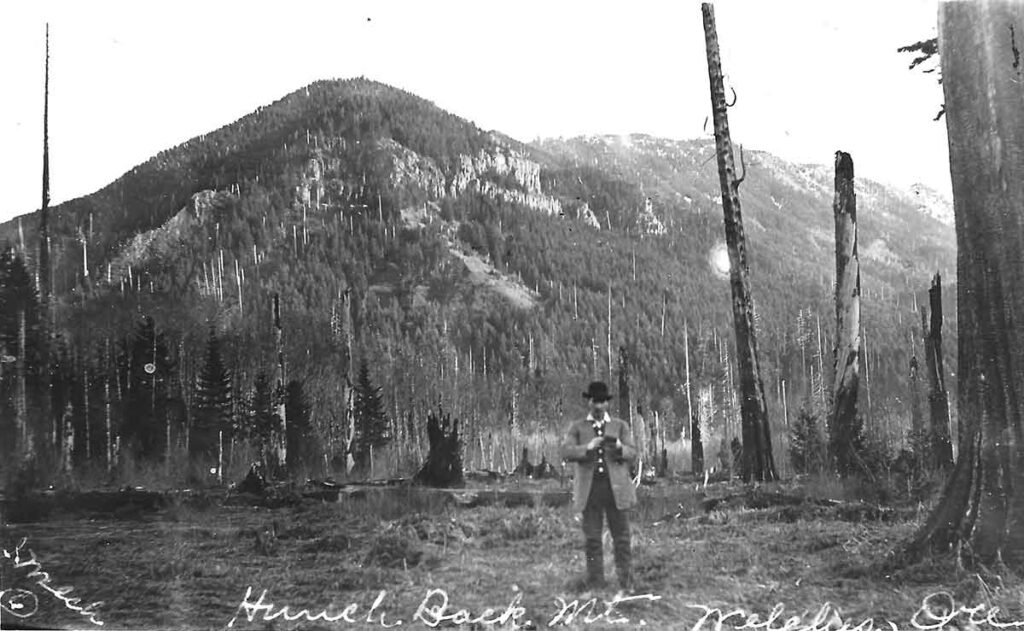
HUNCHBACK MOUNTAIN — This dispatch is being written, believe it or not, inside “The Map” — approximately North Dakota, maybe eastern Montana.

If you’re new here, “The Map” is the namesake of Map Turn — Highway 26’s answer to the masked executioner.

Map Turn is the sweeping curve located west of Government Camp — just downslope from the new truck escape ramp — where several persons have perished in auto accidents in recent years. Eleven to date, according to Hoodland Fire Chief Don Arnimroot. (Interesting footnote: since the state highway department’s safety improvements were installed recently — including the truck escape ramp, new guardrails and better signing — Map Turn has failed to injure anyone!).

All past victims, however, failed to negotiate the fatal Map Turn bend: careening off the brim, down into the teeth of Laurel Canyon. D.O.A.

Hence, Map Turn — at least prior to these highway improvements — had achieved it’s own notoriety. Sort of a lethal hall of life hero. That potential executioner waiting to send the next unfortunate motorist on to St. Peter’s Gate.

But back to the story. Why tag it “Map Turn?” What and where is this “map,” anyway?

To understand the nomenclature, apply the brakes and pull your heap over on this popular corner. Then look west, my friend, look west.

Up there (the here where I now sit) on the eastern facing backbone of distant Hunchback’s ridge, you’ll see it. How unmistakable, really. The Map.

The map of our United States that is.

An almost perfect rendition, too. Including a well defined Florida, the New England states, and — who knows how — even Alaska. Shortcomings include an omission of the Hawaiian Islands and a dwarfed Texas. (Nobody’s perfect).

Now about those long mulled tales defending this as a logged parcel of land purposely chain-sawed and tailored by man. Pure hogwash.

Take it from this hiking boot sore reporter. The Map is a natural phenomenon. A field of giant gray boulders and a few stubborn trees.

Goodness knows how this big stone pockmark ever took on the spitting image of America the Beautiful.

In fact, maybe the roadside term shouldn’t be dismissed as simply the land-mark for a well known highway turn that affords an unblemished view of it.

Perhaps this mysterious handiwork by Mom Nature — or whatever deity you prefer — might be the Mount Hood Corridor’s own sleeping version to England’s intriguing Stonehenge.

At least an appreciative cartographical society might consider somehow honoring our natural tribute to the good old U.S. of A.

Well it’s high time I trudged back down and filed this story. What? How did I get up here in the first place? That’s for you to figure out.

Try using, pardon the repetition, a map.

Reflections on the Map Curve

I’ve passed that curve myself more times than I can count. Paul’s words bring back memories of old maps, dusty road cuts, and the way the forest quietly swallows pieces of the past. These map turns — these forgotten realignments — are more than roadwork; they’re evidence of a changing era, from pioneer trail to automobile highway.

If you’ve ever noticed this spot, or have memories of the old alignment, I’d love to hear your story. Every detail helps piece together the lost landscape of Mount Hood.

Summit Meadow Pioneer Cemetery

The Historic Gravesites at Summit Meadow

A Legacy of the Oregon Trail

Near Government Camp, Oregon, within view of Mount Hood, at the Summit Meadow Pioneer Cemetery, a small white picket fence encloses three pioneer graves. These simple markers remind visitors of the dangers faced by emigrants traveling the Barlow Road, the final and most treacherous stretch of the Oregon Trail. Though many call it a cemetery, it is not an official burial ground. Instead, it holds historic gravesites, marking the final resting places of some of Mount Hood’s earliest travelers.

A Resting Place Along the Barlow Road

In 1846, Samuel Kimbrough Barlow carved out an overland route around the Columbia River Gorge. This trail became known as the Barlow Road, an alternative to the dangerous river route. However, the journey remained treacherous.

As they crossed over the south shoulder of Mount Hood, pioneers used Summit Meadow as a final place to rest and recover while crossing before the final stretch to the Willamette Valley. Unfortunately, some never left. As a result, families buried those who perished in the meadow’s soft ground.

Marked Graves at Summit Meadow Pioneer Cemetery

Inside the white picket fence, are three stones marking three graves. One belongs to Baby Barclay, while the other marks the grave of Perry Vickers. A third, unmarked gravestone stands next to them. According to local stories, Perry Vickers helped bury the Barclay child, even building a small wooden box for the burial.

Baby Morgan Memorial

Just outside the fenced area, another stone plaque honors Baby Morgan. In October of 1847, an infant known only as Baby Morgan died while traveling the Oregon Trail with her family near Mount Hood. The daughter of Daniel and Rachel Morgan, she was born shortly after her mother died from illness on the trail in Wyoming. As the wagon train neared Oregon, the baby was injured during travel and passed away near what is now Summit Meadow. She was buried beside a distinctive rock said to resemble a house with a chimney, a landmark later used by descendants to locate her grave.

Today, a bronze plaque marks the site, honoring her as one of the Oregon Trail’s youngest pioneers. This grave is significant due to its connection with the early Barlow Trail established just a year before.

Although these are the only visible graves, they represent countless unnamed pioneers who never reached Oregon’s fertile valleys who lie in unmarked graves along the way.

Perry Vickers: A Mount Hood Legend

Among the graves rests Perry A. Vickers (1845–1883), an early settler, mountaineer, and innkeeper. He arrived in Oregon in 1865 and built Summit House, a way station for weary travelers along the Barlow Road. His lodge offered food, supplies, and shelter to those crossing the mountains.

In addition to running the lodge, Vickers became Mount Hood’s first known climbing guide. In 1870, he lit bonfires near Illumination Rock, hoping people in Portland could see them. Because of this, he helped promote Mount Hood as a climbing destination.

Tragically, his life ended in 1883. While serving on a posse, he was shot and killed. To honor his legacy, his final resting place became his beloved home at Summit Meadow, where he had spent much of his life helping others.

Perry Vickers buried in the Summit Meadow Pioneer Cemetery.

No Entry, No Official Cemetery

Though the white picket fence surrounds these graves, there is no entrance. The lack of a gate or walkway reinforces that this was never a formal cemetery. Instead, it serves as a memorial, preserving the history of a few Barlow Road pioneers.

A Reminder of Oregon’s Pioneer Past

The gravesites at Summit Meadow Pioneer Cemetery offer a glimpse into Oregon’s pioneer era. More importantly, they remind visitors of the sacrifices, struggles, and stories of those who made the journey west.

Even though the markers are few, their significance remains powerful. Ultimately, they tell the story of hope, hardship, and survival in Oregon’s early days

The Red Devil Toboggan Slide

The Red Devil Toboggan Slide – Government Camp’s Thrill Ride

A Short-Lived Toboggan Slide

In the late 1920s, Government Camp became a hub for winter recreation. In 1927, the Portland Advertising Club built a toboggan slide, ski jump, and ski runs at the east end of town. The slide gave visitors an exciting way to enjoy the snow.

Unfortunately, a fierce windstorm in 1931 destroyed the original structure. Fallen trees crushed the wooden slide, forcing organizers to rebuild. As a result, they constructed a new and improved toboggan slide that same year. The Red Devil Toboggan Slide.

The Red Devil Toboggan Slide, Government Camp Oregon

The Birth of the Red Devil Toboggan Slide

The second slide was longer, faster, and more thrilling than its predecessor. Because of its extreme speed, locals nicknamed it the “Red Devil.” It had a dual-track system and a cable that pulled toboggans back to the top.

Under ideal conditions, riders could reach speeds of 60 miles per hour. As a result, the slide became a major attraction, drawing winter sports enthusiasts from all over. Eventually, the surrounding area even took on the name Red Devil Hill because of the slide’s popularity.

The Red Devil Toboggan Slide, Government Camp Oregon

The Slide Becomes Too Dangerous

However, speed and excitement came with risks. Toboggans sometimes flew off the track, and riders suffered injuries. Over time, accidents increased, and concerns over safety grew.

By 1935 or 1936, the slide was dismantled. Instead, organizers installed one of the first rope tows in the region. Therefore, the focus shifted from tobogganing to skiing, marking a new era for Government Camp.

Summit Ski Area, Government Camp Oregon. What was once the Red Devil Toboggan Slide, Government Camp Oregon

A Legacy That Lives On

The Red Devil Toboggan Slide is gone, but the land still serves as a winter recreation area. Today, it is part of Summit Ski Area, the second-oldest continuously operating ski area in the United States. Originally established in 1927, Summit was first known as the Winter Sports Facility and even served as a rescue base for lost skiers. In 2018, Timberline Lodge’s operators purchased the area and renamed it Summit Pass.

Looking ahead, Summit will play a key role in easing access to Timberline Lodge. Plans are underway to construct a tram that will transport visitors between Government Camp and Timberline, reducing parking congestion at the popular ski resort. While the Red Devil Toboggan Slide is now part of history, the land continues to evolve, serving generations of winter sports enthusiasts.


Summit Ski Area, Government Camp Oregon. What was once the Red Devil Toboggan Slide, Government Camp Oregon

The Early Days of Government Camp Oregon

Echoes from Pompeii Oregon

Government Camp Almost Became Pompeii

There’s a ton of excellent information in this 1911 Oregonian article about the very early days Government Camp/Pompeii Oregon.

The area where Government Camp is located had been known by that name since 1849 when the Regiment of Mounted Riflemen, enroute from Fort Leavenworth Kansas to Fort Vancouver, attempted to cross over the early Barlow Trail late in the season, possibly November or even December, and were faced with severe winter weather. They abandoned 45 wagons that were loaded with supplies, before descending Laurel Hill and down into the Valley. Since then the area had been known as the government camp.

Oliver Yocum, one of the original homesteaders there, was petitioning the postal service for a post office there. He wanted to name the town Government Camp, but the post office had a rule that the name couldn’t be two words, which always seemed to be odd to me considering New York had a post office, but I digress… O. C. Yocum decided that, due to it’s position on the side of a volcano, he would name the town Pompeii Oregon. That didn’t last long before the post office adopted its proper name – Government Camp Oregon.


“The Sunday Oregonian – Sun, May 14, 1911

POMPEII ENJOYS BOOM – SETTLEMENT IN SHADOW OF MOUNT HOOD SHOWS LIFE

Sawmill, Hotel, Water Works, and Electric Lighting and Power Plant Being Built.

The sawmill erected at Pompeii, Government Camp, by O. C. Yocum four years ago collapsed on March 5, causing Mr. Yocum a loss of $3,000. However, it is now being rebuilt by Elijah Coalman, who recently bought the 120-acre tract and Mountain Hotel there.

Transfer of the machinery for the new sawmill was accomplished under remarkable difficulties. Mr. Coalman took possession of the property at Pompeii on March 9 and began erecting the new sawmill. The machinery was hauled by horses to within three miles of Pompeii on wagons. The last three miles of the trip were made on sleds drawn by man power over eight feet of snow. Despite the difficulties, the men, under the direction of Mr. Coalman, overcame the challenges, and the sawmill is now nearing completion. Mr. Coalman expects to start cutting lumber for the new hotel in about 10 days. He currently has about 75,000 feet of logs in the mill yard.

The Meldrum Flume Company has its piping for Pompeii on the ground, and by the middle of summer, the water system will be completed and operational. The surplus water from the plant will be used for power purposes and to operate an electric lighting plant.

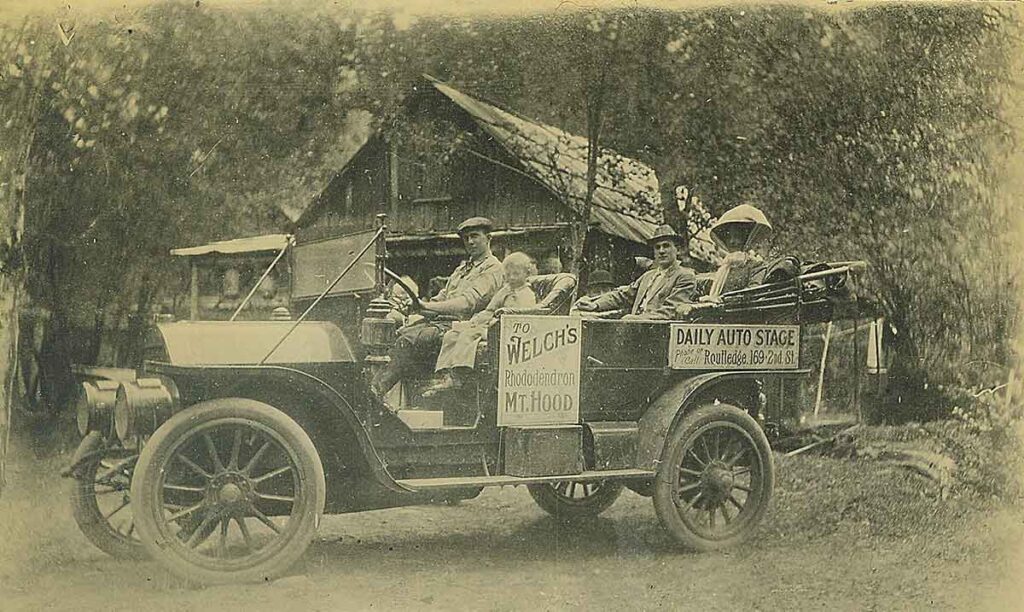
Pompeii was founded and named by veteran mountain guide and pioneer, O. C. Yocum. It is the last and only place from which the ascent of Mount Hood can be made from the south side. There will be six hotels in Western Hood this year—one each at Pompeii, Rhododendron, Welch, Maulden, Brightwood, and Howard. Another hotel is under construction on Salmon River for the Mount Hood Hotel Company by Kern & Routledge.

The new Mountain House at Pompeii will contain 50 rooms; the Mount Hood Hotel Company will offer 40 rooms, and the other resorts have been improved and enlarged.”

The Mountain View Inn

A Lost Landmark of Government Camp

This historic photo captures the Mountain View Inn under heavy snow during the 1940s. Once a well-known hotel in Government Camp, Oregon, the inn played a key role in the town’s early ski culture. However, in 1955, a fire destroyed the building, leaving only memories behind.

A Pioneer Homestead Becomes a Hotel

The building originally belonged to Lena Little, wife of Francis C. Little, a pioneer homesteader. It first served as a private residence, but later, workers moved it to the north side of the main road in Government Camp. This relocation allowed it to become a hotel, serving visitors drawn to the growing ski scene.

Jack Rafferty’s Lodge and the War Years

After the move, Jack Rafferty leased the building and transformed it into a hotel and ski lodge. At first, he named it Rafferty’s or Rafferty’s Hut. Later, he purchased the property, establishing it as a local business.

During its early years, the hotel also went by the name Tyrolian Lodge, reflecting Government Camp’s Alpine influence. However, World War II forced the hotel to close, as tourism slowed and many businesses struggled.

A New Era: The Mountain View Inn

After the war, Harry Albright reopened the lodge and renamed it The Mountain View Inn. As tourism grew, Government Camp became a major skiing destination. With more visitors arriving, the inn became a popular stop for travelers heading to Mount Hood.

A Fiery End in 1955

In 1955, tragedy struck when the Mountain View Inn burned down. It once stood across the street from Daar’s Ski Shop, which later became Charlie’s Mountain View, a well-known landmark today.

Although the inn is gone, its history survives through photographs and stories. This image, showing the snow-covered hotel, serves as a reminder of Government Camp’s past and its early skiing culture.

The Mt Hood Skiway Tram
. The Mount Hood Aerial Transportation Company was formed with a plan to create an aerial tramway to Timberline Lodge on the south slope of Mount Hood from Government Camp, the gathering spot for every activity on The Mountain. It was to be called The Skiway

The Mt Hood Skiway Tram

The Mt. Hood Skiway Tram: The City Bus Tramway to Timberline Lodge

A Vision Before Its Time

In 1947, with World War II over, a new era of recreation began. Skiing had been gaining popularity before the war, and now that peace had returned, people were eager to hit the slopes once again. Mount Hood’s ski scene was entering a golden age, and a group of visionaries saw an opportunity to revolutionize access to Timberline Lodge. The Mt Hood Skiway Tram

That year, the Mount Hood Aerial Transportation Company was formed with an ambitious plan—an aerial tramway connecting Government Camp to Timberline Lodge. The project was named The Skiway (pronounced “Skyway”). If successful, it would provide a convenient alternative to the old Timberline Road, making the mountain more accessible to skiers.

Mt Hood Skiway Tram

The Need for a Tramway

At the time, transportation to Timberline Lodge was limited. Options included:

  • Driving the old road (often rough and challenging)
  • Paying 50 cents for the Timberline bus
  • Hitchhiking (a common but unreliable choice)

If a skier drove, they typically carpooled with others, skied the Glade or Alpine Trails back to Government Camp, and then had to return for the car at the end of the day. The tramway offered a new solution—a skier could ride the tram up, ski all day, and then either take the tram back down or ski back to town.

Mt Hood Skiway Tram

An Engineering Feat

Construction began in 1948, and the project’s design was truly innovative. The plan called for a city bus to function as a tram car, suspended by cables and propelled using a pulley system. Inspired by loggers’ sky hook yarding mechanisms, the bus would be self-propelled, gripping the cable with wheels that guided it up or down the slope.

A lodge at the lower terminal in Government Camp would serve as the passenger station. It featured:

  • A loading platform on the upper level
  • A restaurant, restrooms, and waiting lounge
  • A gift shop

The upper terminal was located at the west end of Timberline Lodge, where passengers could quickly access the ski runs.

Mt Hood Skiway Tram

Challenges and Delays

By 1949, the lodge and tramway towers were completed. However, that same year, a new Timberline Road was opened, providing a shorter, smoother, and safer drive. This easier road access made the tramway seem less necessary.

The winters of 1950 and 1951 brought heavy snowfall, further delaying the project. Originally scheduled to open in early 1950, the Skiway’s first official run was postponed until January 3, 1951. Despite initial excitement, the novelty quickly wore off.

Mt Hood Skiway Tram

Mt Hood Skiway Tram Downfall

Several factors contributed to the Skiway’s struggles:

  • Competition with the new road – Driving to Timberline became easier and more convenient.
  • Cost concerns – The tram fare was 75 cents, while the Timberline bus only cost 50 cents.
  • Profitability issues – Mt Hood Skiway Tram failed to generate enough revenue to sustain operations.

Despite the enthusiasm of early skiers, the financial strain proved too much. After years of struggling, Mt Hood Skiway Tram closed in 1956.

Mt Hood Skiway Tram

A Forgotten Piece of Mount Hood History

Although short-lived, the Mt. Hood Skiway remains a fascinating chapter in the region’s ski history. It was a bold experiment, one that showcased the ambition of those eager to bring innovative transportation solutions to Mount Hood.

Today, few traces of the Skiway remain, but its story lives on as a reminder of a time when skiing was still finding its place in the Pacific Northwest.

Mt Hood Skiway Tram
Mt Hood Skiway Tram
/mount-hood/the-mt-hood-skiway

Government Camp Oregon

The History of Government Camp, Oregon

A Historic Mountain Town on Mount Hood

Perched at 4,000 feet in elevation on the south face of Mount Hood, Government Camp, Oregon, has long been known as a ski town. Long before ski resorts arrived, adventurers made their way to Mount Hood in the winter for snowshoeing and skiing and in the summer for hiking and exploring.

Today, Government Camp is home to the iconic Timberline Lodge, a national historic monument. Built during the Great Depression as part of the Works Progress Administration (WPA), Timberline Lodge remains one of Oregon’s most treasured landmarks.

However, the history of Government Camp stretches back nearly two centuries. Long before it became a destination for outdoor enthusiasts, it played a role in westward expansion and the early days of the Oregon Trail.

How Government Camp Got Its Name

In May 1845, the United States government allocated $75,500,000 to establish military posts along the Oregon Trail. However, when the Mexican-American War broke out, those plans changed. Instead of focusing on Oregon, much of the effort shifted to support the war.

A few years later, in 1849, Lieutenant William Frost led a massive wagon train from Fort Leavenworth, Kansas, to Fort Dalles, Oregon. The scale of this expedition was immense:

  • 429 wagons
  • 1,716 mules
  • 250 tons of freight

While part of the group traveled by boat to Vancouver, the remaining wagons were sent over the Barlow Road toward Oregon City. Unfortunately, this decision had dire consequences.

The mules were exhausted, and overloaded wagons struggled on the rugged terrain. As winter approached, conditions worsened. By the time the wagon train descended Laurel Hill, 45 wagons had been abandoned due to starvation and exhaustion.

For years, this area became known as “the government camp on Still Creek.” Over time, the name stuck, and it was eventually shortened to simply Government Camp.

The Early Settlement of Government Camp

Although Government Camp had earned its name, it didn’t develop into a town right away. It wasn’t until the arrival of O.C. Yocum, Francis C. Little, and William G. Steel that settlement began.

O.C. Yocum’s Vision

O.C. Yocum filed a homestead claim and platted his land into blocks. He named the north-south streets numerically (1st, 2nd, and 3rd). For the east-west streets, he used the letters of his own name:

  • Yule
  • Olive
  • Church
  • Union
  • Montgomery

Originally, Yocum named his town Pompeii. When he applied for a post office under the name Government Camp, the government rejected it, stating that a two-word name was unacceptable. As a result, he changed the post office name to Pompeii.

However, locals never stopped calling it Government Camp, and over time, the name became official.

Hotels and Businesses in Early Government Camp

As travelers increased, hotels and businesses emerged to accommodate them. Several of these establishments played a key role in shaping Government Camp’s reputation as a mountain resort destination.

Notable Hotels and Businesses in Government Camp

  • 1899 – O.C. Yocum built the Mountain View House hotel.
  • 1910 – Lige Coalman purchased the hotel and, in 1911, built the Government Camp Hotel.
  • 1933 – Both hotels burned down.
  • 1924 – Everett Sickler and Albert Krieg built the Battle Axe Inn, a popular gathering place. It burned down on November 7, 1950.
  • 1932 – Charlie Hill built and ran Hill’s Place, located across from the Battle Axe Inn. It operated for decades before burning down in 1969.
  • The Rafferty Family built a hotel next to the Battle Axe Inn. It changed hands and names several times, known as the Tyrolean Lodge and later the Mountain View before it burned down in 1954.
  • George Calverly built a café at the east end of town, which his wife managed.

As the 20th century progressed, Government Camp became synonymous with outdoor recreation, particularly with the rise of skiing on Mount Hood.

Government Camp Today: A Legacy of Adventure

Today, Government Camp remains the gateway to Mount Hood’s winter and summer sports. It is home to Timberline Lodge, and the town continues to attract skiers, snowboarders, and hikers year-round.

Though many of its original buildings have disappeared, the spirit of Government Camp lives on. From its Oregon Trail roots to its role in shaping outdoor adventure culture, Government Camp remains one of Oregon’s most historic and beloved mountain towns.

Discover More Mount Hood History

If you love learning about Oregon’s past, check out more stories at MountHoodHistory.com.

Have memories or stories about Government Camp? Share them in the comments below!