The Modern Barlow Trail Road

The Modern Barlow Trail Road

The Historic Paths of Barlow Trail Road and Lolo Pass Road

Have you ever driven along Barlow Trail Road or Lolo Pass Road and wondered about their origins? These quiet, winding roads are more than just modern routes—they are living pieces of history.

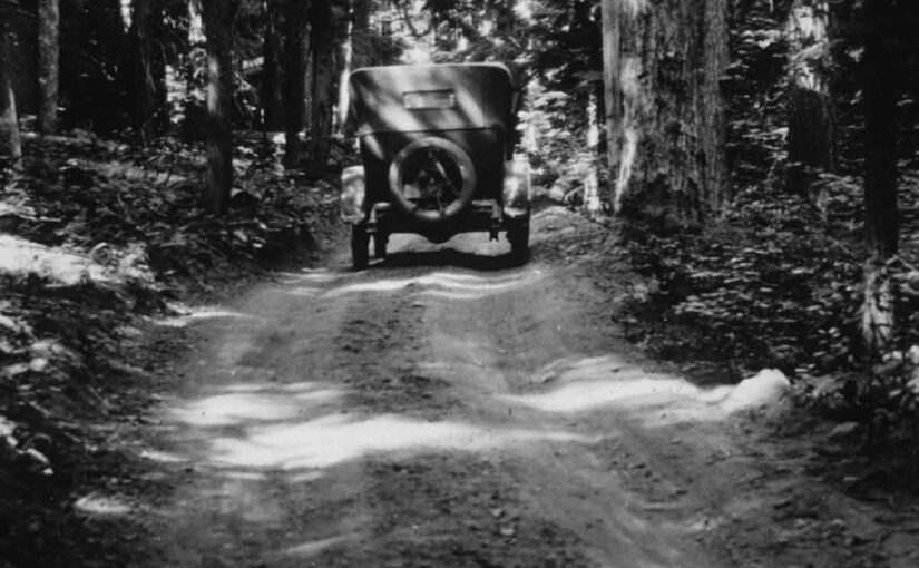
Long before cars or bicycles rolled over them, these paths were game trails and footpaths used by the region’s first inhabitants. Later, Oregon Trail pioneers relied on them as lifelines to complete their westward journey. Over time, they evolved into crucial connections for local residents and the modern communities we know today.

  and wondered about their origins? These quiet, winding roads are more than just modern routes—they are living pieces of history.

From Wagon Wheels to Hackett Road

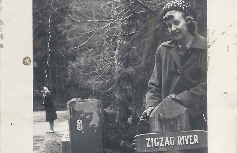
In the mid-1800s, the original Barlow Trail served as a rough but vital route for settlers completing the Oregon Trail. As pioneers descended from Mount Hood, they followed the north side of the Zigzag River until they reached the Sandy River. At the big bend of the Sandy, they crossed over a log bridge built by settlers.

Later, the trail shifted to the south side of the Sandy River, leaving behind remnants of the earlier path. As a result, settlers repurposed parts of the old trail into local roads, including Hackett Road. This road, named after early settlers in the area, still carries their legacy in the name of nearby Hackett Creek.

The McIntyre Bridge: A Critical Connection

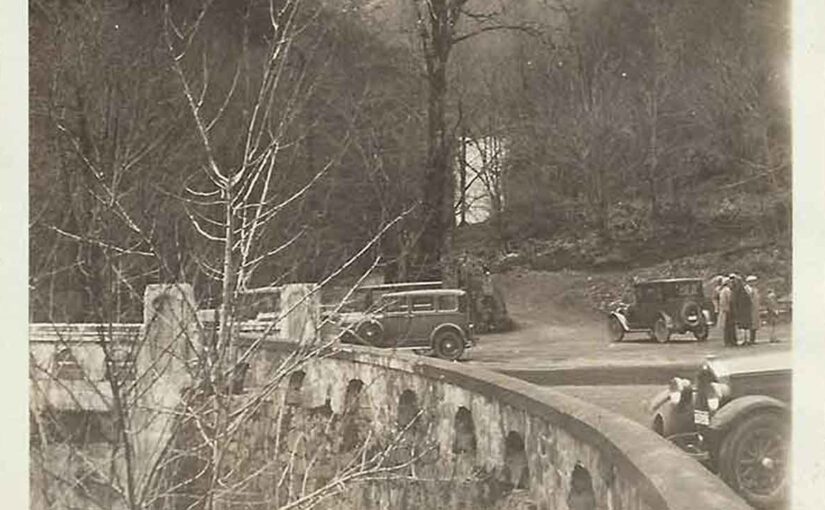
By 1910, settlers struggled to access the road on the north side of the Sandy River. Early bridges were unstable and often washed away, making travel difficult. That year, J.T. McIntyre, an early settler in Brightwood, took action. He built a sturdy bridge over the Sandy River, providing reliable access to the road on the north side.

This new bridge transformed travel in the area. Residents could now cross the river safely, and it became a key link for the growing community. Without McIntyre’s efforts, settlers on the north side would have remained isolated from the developing Mount Hood automobile road nearby. Consequently, his work played a crucial role in connecting these remote settlements.

  and wondered about their origins? These quiet, winding roads are more than just modern routes—they are living pieces of history.

The Road to The Truman Farm

Around the same time, Ezra and Eliza Truman homesteaded on the north side of the Sandy River, near Zigzag Ridge. Ezra, a mountain guide and farmer, relied on the newly connected road to reach his homestead. He used it to deliver milk and produce to his neighbors.

Over time, this route became known as Truman Road, named after the family who lived at its farthest end. Even after Ezra’s death in 1917, the road remained essential. It provided access to settler homes, cabins, and lodges, supporting the early tourism industry that grew alongside the increase in automobile travel to Mount Hood. Because of this, the area became a gateway for visitors exploring the region.

  and wondered about their origins? These quiet, winding roads are more than just modern routes—they are living pieces of history.

DeVeny Road: A Valuable Connection

In the early 1900s, Dr. William DeVeny, a Zigzag cabin owner and civic leader from Montavilla (now part of Portland), saw the need for better road access. With support from the Mount Hood Improvement Association and local government funding, he led the construction of DeVeny Road.

The new road linked the Mount Hood automobile road on the south side of the Sandy River to the east end of Truman Road on the north side. By 1913, the project was complete. Bridges were built over Bear Creek, the Zigzag River, and the Sandy River, creating a vital route for settlers, forest rangers, and early visitors to the Mount Hood wilderness. As a result, travel between the two sides of the Sandy River became much easier, further opening the area to development.

  and wondered about their origins? These quiet, winding roads are more than just modern routes—they are living pieces of history.

A Modern Legacy

As time passed, these roads continued to serve local communities while adapting to modern needs. In 1979, the Clackamas County Historical Society honored the pioneers by renaming Truman Road to Barlow Trail Road. This change recognized the historical importance of the original Barlow Trail.

Meanwhile, DeVeny Road became part of Lolo Pass Road, and its original name faded from memory. Yet, the routes themselves remain a testament to those who built them. Although the names have changed, their significance has not been forgotten.

Roads Worth Remembering

Today, whether you’re coming home, heading out, or simply enjoying a scenic drive, you are traveling through history. These roads are more than just asphalt and gravel—they are stories of resilience, determination, and community.

So, next time you find yourself driving down Barlow Trail Road or Lolo Pass Road, take a moment to appreciate the history beneath your wheels. After all, you are following in the footsteps and wagon tracks of those who came before us

  and wondered about their origins? These quiet, winding roads are more than just modern routes—they are living pieces of history.
The Ivy Bear at Alder Creek

The Ivy Bear at Alder Creek

The Rise, Fall, and Revival of the Ivy Bear at Alder Creek: A Highway 26 Landmark 

For decades, travelers along U.S. Highway 26 in Oregon have been greeted by a unique roadside landmark: the towering Ivy Bear at Alder Creek. Covered in thick vines and steeped in local lore, this massive figure has become a beloved symbol of the Mount Hood area. Built as a tribute to a pet bear, it eventually collapsed, but thanks to a dedicated community, it rose again.

The Ivy Bear in 1959

The Man Behind the Ivy Bear at Alder Creek

The story of the Ivy Bear begins with Gerald Wear, a deaf craftsman, dog trainer, and builder who lived in Alder Creek. Wear was widely known for his ingenuity and deep love for animals. Alongside training German Shepherds, he also cared for a bear that lived in a roadside cage. As travelers passed along the two-lane highway, many stopped to watch the bear, which quickly became an unofficial mascot.

Gerald Wear the builder of the Ivy Bear

Eventually, the bear passed away. According to local accounts, it died after consuming too many candy bars, soda pop, and bottle caps handed out by curious onlookers. Heartbroken, Wear felt compelled to honor the animal. He decided to create a much larger tribute: a towering ivy-covered bear that would stand beside the road for all to see.

The bear at Alder Creek

Building the Largest Ivy Structure in the World 

In 1947, Wear began construction on what would become the Ivy Bear at Alder Creek. He built a wooden frame, wrapped it in chicken wire, and carefully planted ivy around the structure. Over the course of more than a year, the vines filled in, eventually covering the entire bear.

In the news

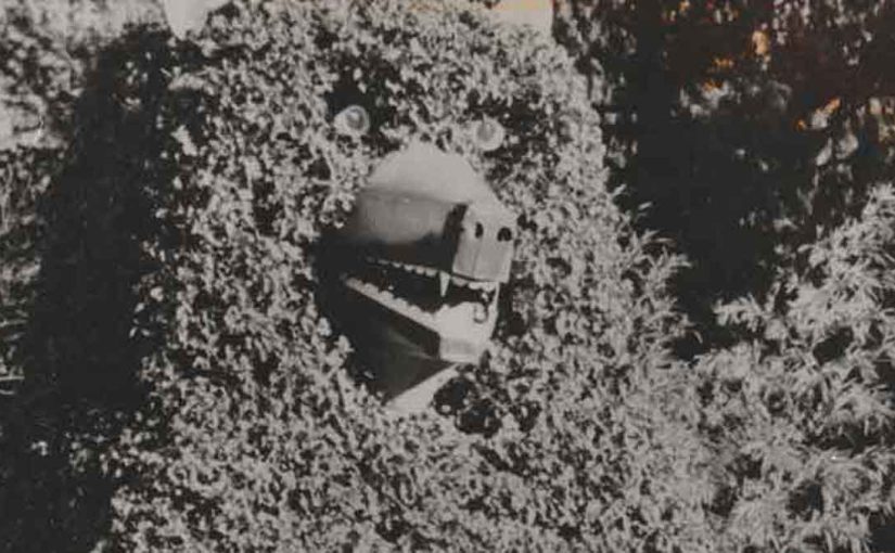
At the time, the figure was believed to be the largest ivy-covered structure in the world. Motorists quickly became accustomed to the sight of the massive bear keeping watch near the highway. To make the figure even more lifelike, Wear added a rear door and scaffolding inside that led up to the bear’s head. At night, he would climb inside and light its eyes with candles. Later, he upgraded them with old Volkswagen taillights.

The Ivy Bear showing the original eye which were replaced by Volkswagen taillights.

A Growing Landmark Along Highway 26

Over time, the Ivy Bear at Alder Creek became even more popular. In fact, it eventually became better known than the businesses located on the property. Mount Hood skiers adopted a tradition of saluting the bear for good luck, and children often lifted their feet as they passed by.

Meanwhile, Wear continued working on creative projects in Alder Creek. In addition to the bear, he built homes and decorative water wheels. Although Wear passed away in 1972, his most famous creation remained standing—a lasting testament to his creativity and love for the area.

Healthy Ivy on the bear.

The Fall of the Ivy Bear in June 1984

After nearly 40 years of standing tall, the Ivy Bear collapsed on June 18, 1984. A gentle breeze that evening was all it took to bring down the aging wooden structure. The bear toppled forward and landed on its tin snout.

Upon closer inspection, the cause became clear: the wooden beams at the base had rotted through. Without a strong foundation, the structure simply gave way. Although exterior damage was minimal, the bear could no longer stand upright.

The loss resonated with the community. Travelers slowed down, searching for the familiar landmark. Even the Portland Chamber of Commerce reached out to the property’s owners, eager to help restore the iconic roadside figure.

Largest Bear In The World

A Community Comes Together

Recognizing the Ivy Bear’s cultural value, local residents and organizations launched a campaign to bring it back. In 1987, Ron Rhoades, owner of the Ivy Bear Restaurant, partnered with Michael P. Jones of the Cascade Geographic Society and the Friends of the Ivy Bear to start a fundraiser.

By 1990, their efforts paid off. The community raised enough money to rebuild the Ivy Bear—this time using a steel frame designed to withstand time and weather. Thanks to their perseverance, the Ivy Bear stood once again.

The Ivy Bear in need of new ivy.

The Ivy Bear Returns to Alder Creek 

The bear’s revival brought renewed energy to the Mount Hood area. Locals and travelers alike celebrated the return of the iconic figure. Once more, the Ivy Bear stood proudly along Highway 26, welcoming visitors and honoring its unique history.

Today, the Ivy Bear remains a bit overgrown but continues to charm passersby. It stands not only as a tribute to Gerald Wear’s craftsmanship and compassion but also as a symbol of community pride. Next time you drive through Alder Creek, don’t forget to salute the bear—just like generations before you.

The Largest Bear in The World